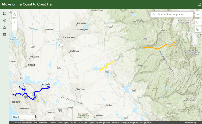
- Blue – East Bay – Contra Costa County
- Yellow – Camanche – Pardee
- Orange – Upper Mokelumne River Canyon
- Delta and Middle Mokelumne Segments are not reflected here, their alignment is not defined
Waypoints (KMZ file) download page. After downloading, view in a GPS app on your device, or on Google Earth
Visit EBRPD’s online East Bay Regional Parks maps
Description
- West boundary is Carquinez Strait Regional Shoreline’s Nejedly Staging Area, in Martinez. Another alternative is Inspiration Point in Berkeley. Both overlook the San Francisco Bay where the Mokelumne River ends. This is also Mokelumne Coast to Crest Trail’s western end.
- East boundary is at Big Break Regional Shoreline in Oakley, adjacent to the gateway to the Delta across the Antioch Bridge
- Located in
- East Bay Municipal District’s San Pablo Reservoir Recreation Area
- Various East Bay Regional Parks
- Various East Bay Regional Park regional trails
- Mount Diablo State Park
- Parks and trails are regulated independently by each park, preserve, open space or trail for hiking, equestrian use, and mountain biking. Visit specific websites or call for more information
Day Rides & Hikes East Bay Regional Parks website is the place to go for a comprehensive trail list and descriptions.
Easy
Challenging
Difficult
Activities
Hiking, biking and horseback riding activities can be combined with camping at designated campgrounds. Also consider fishing, swimming, birding, wildflower walks, highpointing, peak bagging, trail running
- Signage – Where the trail is signed it is marked at intervals with oval colored logo signs on trail posts.
- Leave-No-Trace—The MCCT Council supports and encourages LNT practices while on the trail.
- Camping – is regulated by individual parks
- Fire – Fire danger can be extreme, and fires, camp stoves, and smoking may be prohibited.
- Side Trips – TBA
Trail Conditions
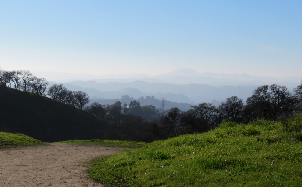
Trails vary widely in grade. Climate varies depending on location and season
Access
Various trailheads throughout the segment. Each park and trail manages trailheads independently
Accomplishments to date
Mount Diablo State Park staff and Mount Diablo Interpretive Association (MDIA)
- Defined trail alignment
- Signed trail junctions in the trail footprint
- Opened trail between Briones-Mt Diablo Regional Trail and the town of Clayton
East Bay Regional Park District
- 1993: EBRPD dedicates the MCCT
- October 2009: First map panel installed at Nejedly Staging Area in Carquinez Regional Shoreline
- March 2011: Defined alignment on existing trail between Nejedly Staging Area and Big Break Regional Shoreline
- March 2011 – present: posted trail signs at trail junctions and trail heads; update website maps and brochures
East Bay Municipal Park District
- Dedicated trail
- First section of MCCT signed here
- Defined alignment on existing trail in San Pablo Reservoir Recreation Area
- Signed trail junctions
Mokelumne Coast to Crest Trail Council
- Collaborated with EBRPD to complete signage project across all EBRPD lands
- Collaborated with Mount Diablo State Park officials and MDIA to approve and complete signage project
Recent project status
EBRPD is upgrading Orwood Bridge and plans to extend the MCCT to the bridge. Orwood Bridge is located east of Brentwood. EBRPD’s plans call for a new park in the area adjacent to the bridge, in the Orwood tract. It will be called the Great Delta Park.
Remaining Work to Complete Segment
Signage is needed along Big Break Trail and at Big Break Regional Shoreline Park.
The Trail Council is collaborating with the Delta Protection Commission to sign trail across the Antioch Bridge and in to the Delta.
Partners
East Bay Regional Park District (EBRPD)
Contact: Anne Kassebaum, Chief of Interpretive & Recreation Services (510) 544-2551
Mark Ratz, Chief of Park Operations (510) 544-2511
Sean Dougan, Trails Development Program Manager (510) 544-2611
Mount Diablo State Park
Contact: Mark Sinclair, Park Maintenance and Trail Coordinator (925) 837-6122
Mount Diablo Interpretive Association (MDIA)
Contact: Mike Woodring
East Bay Municipal Utility District (EBMUD)
Contact:
Delta Protection Commission
(916) 375-4534
Blueprint for Contra Costa & Solano Counties, September 2010
American Discovery Trail
Contact: John Fazel runmtns@prodigy.net
Upcoming Events and Volunteer Opportunities
Recent Events
Anniversary Trail Party on Carquinez Strait Loop October 3, 2009
We hope you enjoy the MCCT in East Bay! To receive additional information, contact:
Mary Boblet, Trail Council Director 209-287-2268, mboblet@gmail.com
