After opening map, type “Pacific Valley” in search field
Waypoints (KMZ file) download page. Includes Pacific Valley. After downloading, view in a GPS app like Google Earth, type in ‘Mosquito Lake’ and ‘Pacific Valley’ in the Search box to locate general area.
An Alltrails map for this up and back day hike is now available!
Features
- Day hike, up and back starting at Mosquito Lakes trailhead with turnaround at Pacific Valley Rd-Milk Ranch Meadow trail junction
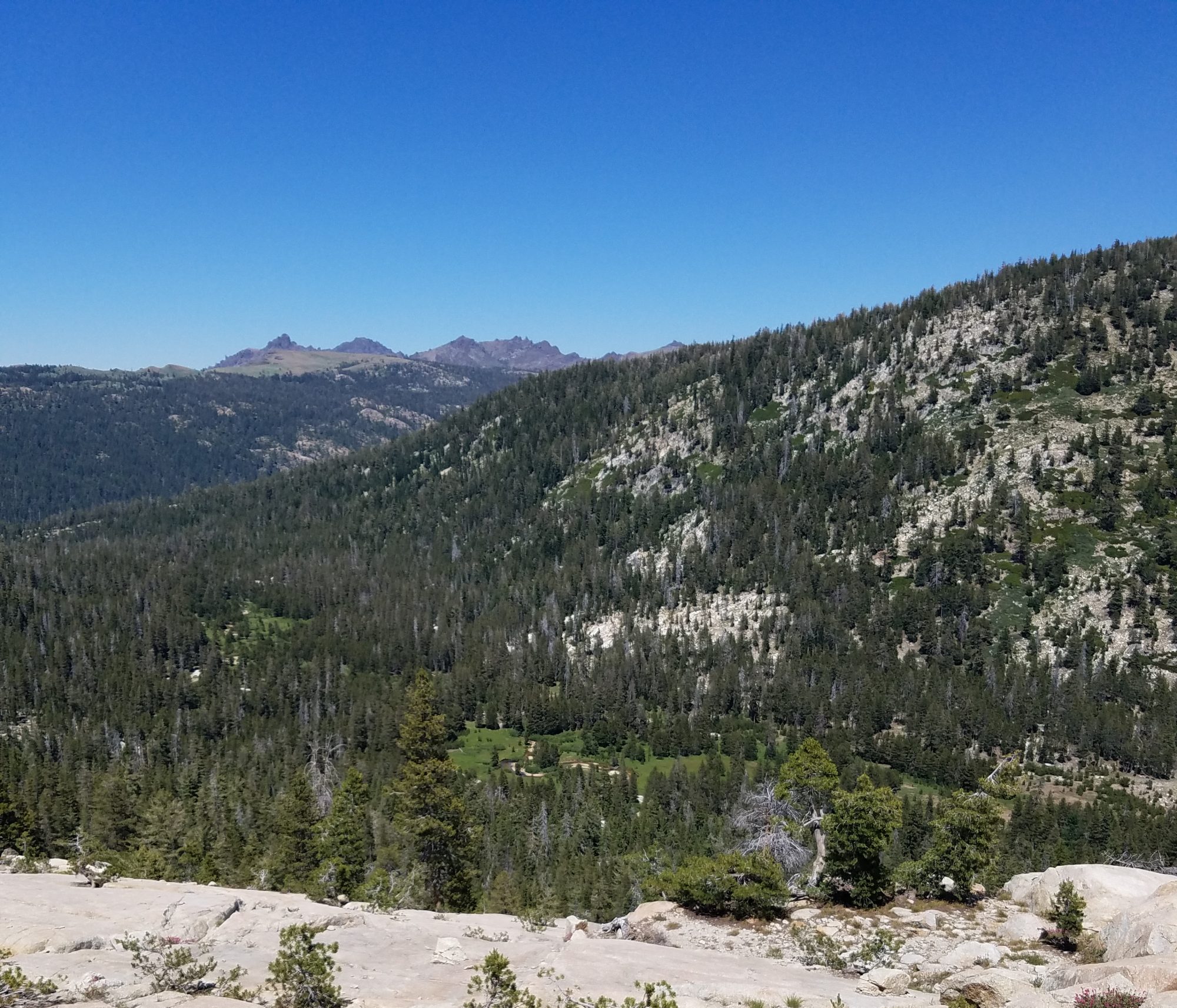
- Meandering trail enters picturesque Pacific Valley via ridge from Mosquito Lake
- Scenic views
- Mid season wildflowers (date varies), aspens turning in fall (date varies)
- Access off Hwy 4
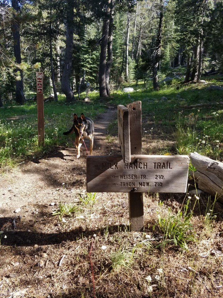
- 1.85 miles to the Milk Ranch Meadow trail sign before returning to trailhead
- Staging for extended backpacking or camping in Stanislaus National Forest or Carson Iceberg Wilderness
Trail Places and Photos
Mosquito Lake to Pacific Valley Trail Day Hike Description
- Trail is up and back. One way length – 3.6 miles
- Dirt surface, width varies, snow depth significant in the winter
- Shaded and unshaded
- Little to no cell phone service
- Post messages at Pacific Valley Campground
- Trail leaves Mosquito Lake, traveling up a moderately steep ridge trail and then drops down into Pacific Valley on a moderately steep trail
Trail Accessibility
This trail is not wheelchair accessible
Side Trips
- Carson Iceberg Wilderness is southeast of the trail. Permit required to enter this wilderness. Get it and maps at the Alpine Ranger Station, Highway 4, Bear Valley, CA .
- The town of Bear Valley features restaurants, grocery, fuel, developed recreation excursions, & hotel
- Bouldering near Bear Valley
- Swimming, paddling, and non-motorized boating at Lake Alpine, on Hwy 4.
Parking and Staging
Parking and roads are impacted by weather. Area trailheads inaccessible in winter and possibly into late spring by vehicle. Talk with the Stanislaus National Forest Calaveras Ranger District representative at 209-795-1381 when planning your trip.
- Mosquito Lake Trailhead (also called Heiser Lake Trailhead)
- primitive parking area, no trailer parking at lakeside
- primitive parking area, on opposite side of hwy from lake, no trailers, no large RVs – no turnarounds
- Closest staging areas for trailers
- staging and camping at the MCCT Lake Alpine trailhead Chickaree Day Use and various sites around the lake
Pacific Valley Trail Safety
- Stay on trails
- Pack in your own water and food
- Carry a GPS and bring a friend along
- Weather changes rapidly in the high country. Check weather before going on the trail or be prepared for adverse weather
- Signage – where the trail is signed it is marked at intervals with oval green, beige and white logo signs on 4×4 trail posts
- Leave-No-Trace—The MCCT Council supports and encourages LNT practices while on the trail
- Fire – Fire danger can be extreme, see Stanislaus National Forest‘s rules and regulations
The Pacific Valley trail was completed and signed in 2015 by the US Forest Service

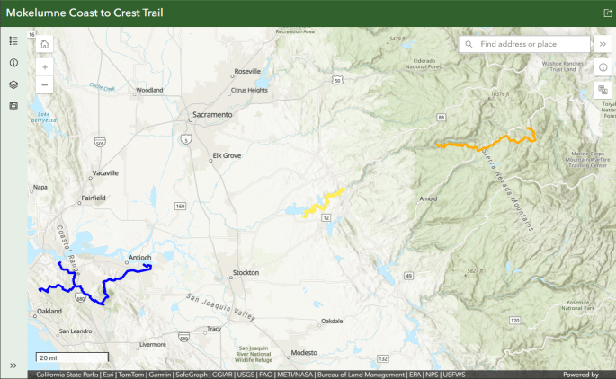
what kind of parking is available at the mokelumne river end of the trail marked in Orange on your map
The orange area has two ‘ends’. Which one relates to your question?
I have the same question. How about horse trailer access to the very west end of the orange trail? Which is the best entry road- Hwy 88 (Ellis Rd, Salt Springs Rd), or from West Point (Winton Road), or from Hwy 4 (where?)