This trail is a nice day hike on a slice of the Mokelumne Coast to Crest Trail. It is very close to the trail’s end at Martinez Regional Shoreline, the place chosen by the trail council to represent the Mokelumne River’s connection to the Pacific Ocean.
It is named in honor of Hulet Hornbeck, a well-remembered East Bay Parks Parks planner and trails enthusiast. This trail blends with the California Riding and Hiking Trail, an idea created over seventy years ago by a California State planner who thought California should have a closed loop trail running the length of the state. This trail is one of only a few remaining segments today.
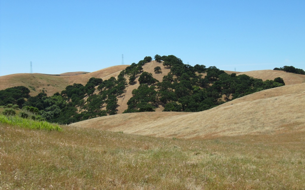
The trail’s path begins in the Carquinez Strait Regional Shoreline and then heads up the exposed ridge south of the Carquinez Strait, ending in the Alhambra Valley of Martinez where you can visit John Muir’s home, a national historical site (undergoing restoration between January & mid-May 2011)
 Hulet Hornbeck Trail
click image for full size view


Features
- Moderately challenging day hike
- Scenic views
- John Muir National Historical Site
Trail Description
- 3 miles, one-way
- wide, unpaved surface
- first and last legs of the trail are short and steep
Trail Accessibility
Parts of this trail are wheelchair accessible according to East Bay Regional Parks District.
Area History TBD
Side Trips
- John Muir National Historical Site and Visitor Center
- Mt. Helen Trail
- the town of Martinez and waterfront park
- Martinez Regional Shoreline – site of the 1993 Coast to Crest Trail Relay end
- Carquinez Scenic Drive
Parking
- parking near John Muir Historical Site (Franklin Canyon & Alhambra)
- parking at Nejedly Staging Area, off Carquinez Scenic Dr., Martinez
General Trail Safety
- Use between sunrise and sunset
- Stay on trail
- Carry water and snacks
- Carry a GPS and bring a friend along
- Signage – Where the trail is signed it is marked at intervals with oval green, beige and white logo signs on 4×4 trail posts
- Leave-No-Trace—The MCCT Council supports and encourages LNT practices while on the trail
- Camping – Not allowed on the trail.
- Fire – Fire danger can be extreme, and fires, camp stoves, and smoking are prohibited

I would like to know where to cross Alhambra Ave in Martinez. The trail map of the Hulet Hornbeck trail shows it crossing the street just South of Highway 4. The signage on the trail marker posts stop at Alhambra Ave. and pick up again on the other side. I don’t think jaywalking was the intent but there is an island formed by double yellow lines in the middle of the street. This is a wide spot to wait for passing cars if you can’t dash across all at once. I only did this once with my children. Please let me know where to cross. Thank you, Dorothy Becker
Hi Dorothy,
Since I live in the Sierra Nevada and have yet to travel down there, I located a map that I used to create our trail alignment, showing what I think is a hwy 4 underpass, just west of the Alhambra/Hwy 4 intersection. I would suggest contacting the John Muir Historical Society for specifics. Or contact a person by phone with East Bay Regional Parks Carquinez Strait Shoreline Regional Park at 925-228-0112 or Toll Free: 888-EBPARKS (888-327-2757), option 3, extension 4514.
The map web page is http://www.ridgetrail.org/images/interactive_map/maps/MartinezStreetsAndCarquinezStraitShorelineToMt.Wanda.pdf.
I am outside phone range today but will also make a call and post the information here for future reference. Thank you for your question and comments Dorothy!
Hi Dorothy,
There is a tunnel! It is a pedestrian/bike tunnel under the highway called the Franklin Canyon tunnel. I checked with the Carquinez Strait Park office this morning. Happy hiking!
Hi, The tunnel is great. I use it all the time. The problem is crossing Alhambra Ave. On the map is a big P for the Park and Ride lot on the corner of Alhambra Ave. and Franklin Canyon Rd. That is the exact spot you have to run across the street. I talked to a woman on horseback and she says the cars sometimes scare her horse. She has to wait a long time to cross but has been doing it for 20+ years. Going westbound, the trail comes out about 100 feet or so south of the intersection with Franklin Canyon Rd. I can still run fast for being in my sixties but sometimes I have to wait in the middle of the road for it to clear. That is one reason I wear trail running shoes instead of hiking boots. Dorothy Becker
Hi there,
I agree. Earlier I thought you were talking about crossing hwy 4. The CA Riding and Hiking Trail starts at that parking lot on Alhambra and my google earth street view check definitely identifies an issue crossing Alhambra. The East Bay Parks District might have a plan to bring in a crosswalk there. I will check in with them. Wouldn’t hurt if we all called in to express our opinion on this. Carquinez Strait Shoreline Regional Park at 925-228-0112 or Toll Free: 888-EBPARKS (888-327-2757), option 3, extension 4514. Happy trails Dorothy. Come and see us sometime in the foothills or high country! — Mary
Do they allow dogs in this park? I only see horse, bike, hike signage on the map.
Thank you.
yes! I googled, just to be sure. It seems each EBRPD trail has its own limits/guidelines. The horse, bike and hike on our site refer to modes of transportation only. Have a great time on the trail, and feel free to share photos.