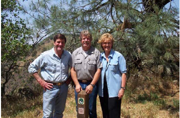
l to r: Rep. John Garamendi, Steve Diers, Patti Garamendi
We are thrilled to announce the Mokelumne Coast to Crest Trail podcast, beautifully arranged and edited by our partner, the US Forest Service – Stanislaus National Forest.
This podcast is expertly edited and chock full of photos and history we want to share with you. Our trail’s story isn’t unique. But it is a story of how California’s trail supporters and state governmental bodies work together so that the beauty and history that is California can be enjoyed by all.
Whew! Little did we know that the longer you’re around, the more material is acquired and is worthy of presenting! Today we are honored to join the US Forest Service to present at their Virtual Live series which they conduct in the months before the seasons make it possible to visit most of the forest.
A video of the presentation will be made available shortly, and we will prepare a list of resources for your consideration, related to the information in the video. I hope you enjoy the presentation tonight and will enjoy the video once we post it here!
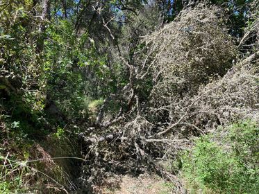
Trail supporter Tina reports two trees are down (she also sent in these photos) on Rich Gulch trail this afternoon, that for now makes the trail impassable. EBMUD is sending out maintenance crew to attend to it. Please call EBMUD Sierra Trails office at 209-772-8204 to get updates if you plan to head out there today or anytime this week. We do not have a time estimate for when the trail will be clear. Thank you Tina!
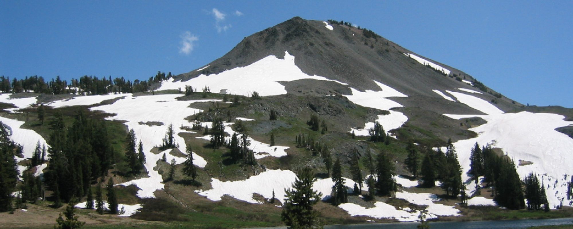
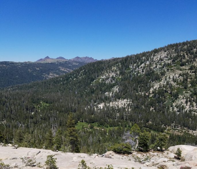
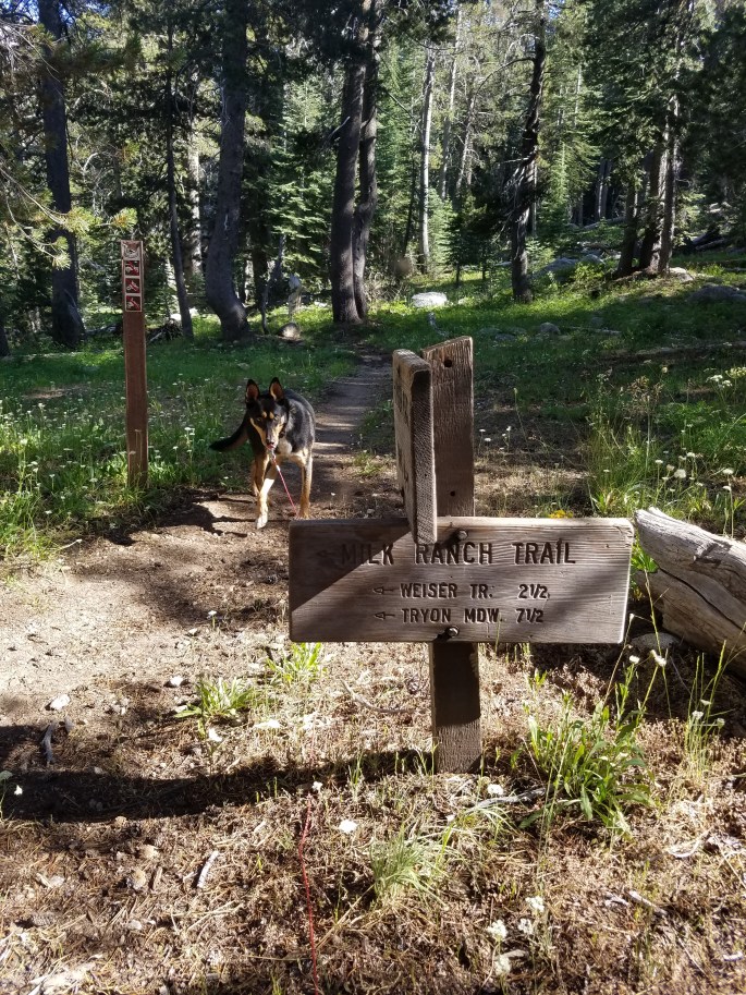
Today we’re recommending a moderately challenging day hike with some cardio ridge climbing, expansive Sierra view, and a path through a favorite forest meadow.
It’s a great time to be up at altitude. Web trail inventory provider AllTrails makes it easier with their easy to use tools, replacing another inventory company called EveryTrail. We are grateful for AllTrail’s services.
Visit the MCCT day hike page and start planning your day hike!
We are skipping the organized 5k & 10k and instead we will do a fun run on a 1 mile loop around the campgrounds, you can do one or more loops. This is open to runners of all ages. The fun run will not be timed. Starts at 7:00pm and it will be followed with a bonfire.
Both distances start from the Gold Run campsite area. The course is an out and back course on the Coast to Crest Trail. Click on the distance to find more information. Our 50 mile race is a UTMB qualier race (4 Points).
The Half Marathon race is a point to point course, runners will get picked up from the Gold Run camping area at 8am. Runners will then be shuttled to “Campo Seco staging area” where the Half Marathon starts at 9:00am. Click on the distance to find more information.
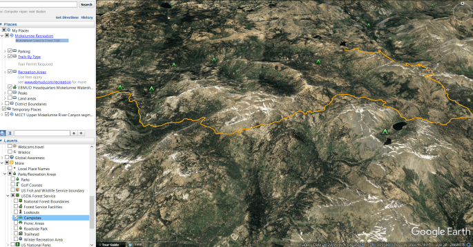
Google Earth is a free application that provides a remarkable aerial view. You can pan and zoom from campsite to water source, peak to valley. Features such as park and wildfire boundaries, roads, cloud cover and current snow pack totals can be displayed.
With a little computer savvy, users can calculate elevation gain and loss, display elevation profiles, see which campsite will receive the first morning sun or what stars will be overhead for an exact time and place.
The MODIS Fire Detections KML layer shows fires. Visit the main page here. This is satellite data that updates automatically. MODIS is 1 km resolution, so 1 km2 forms a cell. When a cell is ‘turned on’ (showing heat), there is a 50% chance there is fire within that cell. In other words, it’s also not very accurate.
The GeoMAC active fire perimeter KML shows large incidents, and their actual heat perimeter. This data is generally gathered by airplanes flying over the fires. Updates might not happen every day. While the GeoMAC layer is detailed, it might not be up to date. Nor does it show all fires. Generally, only the large, longer burning fires get airplane overflights and end up being shown in the GeoMAC layer.
Every day, the Terra satellite’s MODIS instrument takes a color picture of Earth. You can see it on our daily satellite image page or on NASA Worldview. If you click the camera icon in Worldview, you can export that day’s satellite image into a KML file and load it into Google Earth. So neat!
* Don’t trust your life to the information you gather from Google Earth.
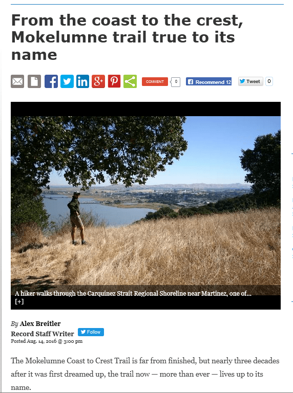
Stockton Record’s Alex Breitler serves up this humbling trail testimonial. It goes beyond saying that dozens and dozens of individuals and agencies contributed to laying down trail and helping visitors travel safely on it.
Delivering a 1988-2016 retrospective is the next task. We are sifting through literally hundreds of historical documents, maps and images going back to 1988. Stay tuned!
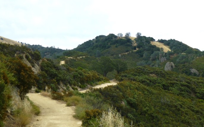
Even more trail goodness! This time Mount Diablo State in the East Bay – Contra Costa County segment.
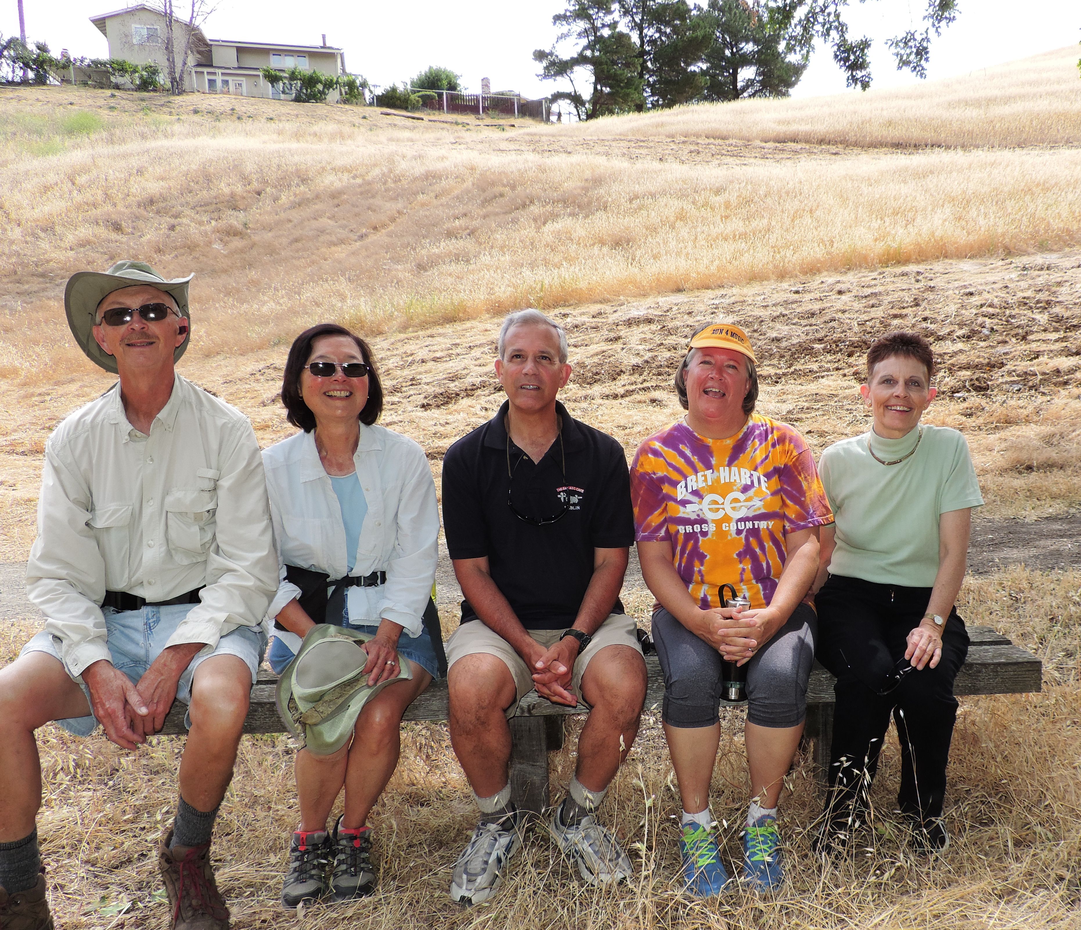
In June – September 2015, Mount Diablo State Park officials, Mount Diablo Interpretive Association, town of Clayton, and the trail council worked together scouting potential alignments & attaching trail signs on posts. We are grateful to Mark Sinclair of State Parks, John Mercurio, and MDIA’s Mike and Ruth Ann Woodring for completing the state park signing.
Mike and Ruth Ann Woodring, John Mercurio, Mary Boblet, Laura Hoffmeister (town of Clayon representative)
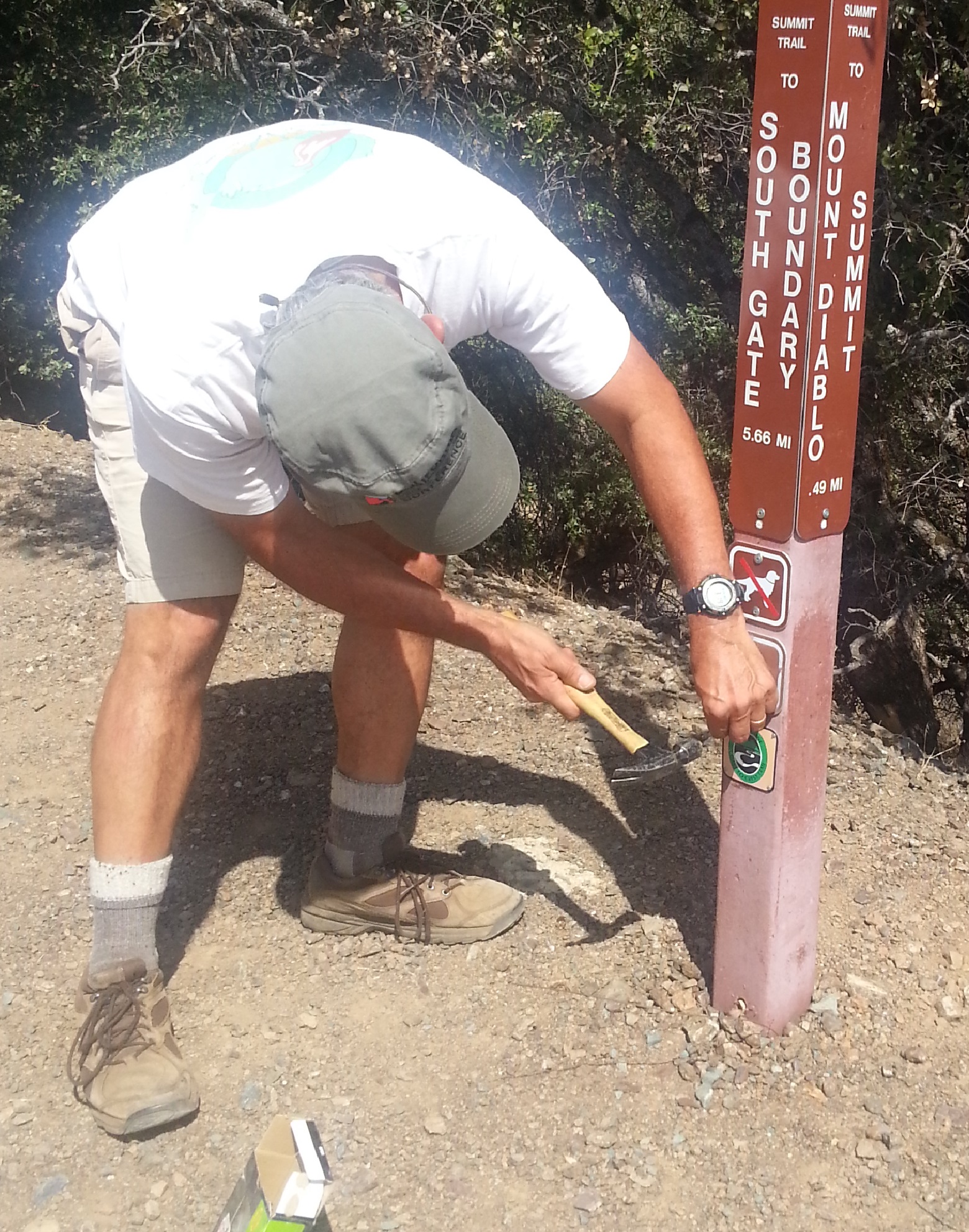
John Mercurio, installing sign
The result: newly open trail entering the park from the southwest via the Briones-Mt Diablo Regional Trail (managed by East Bay Regional Park District) and from the northeast via the town of Clayton (home to MCCT trail-co founder George Cardinet Jr.)
Hooray!! The MCCT is now continuous between Martinez (and Berkeley) to Antioch’s Big Break Regional Shoreline, the gateway to the Delta. This announcement marks the 2nd completed MCCT segment, with three segments to go (another completed segment is planned to come online in 2018.)
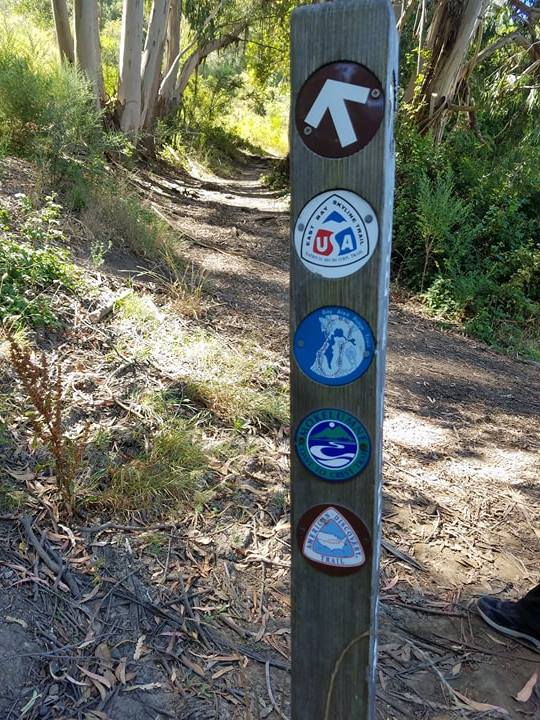
Busy trail junction in Berkeley with Meadow Canyon Trail, East Bay Skyline Trail, & Bay Area Ridge Trail
View the Mokelumne Coast to Crest Trail map free on ArcGISOnline. After checking out the map, plan your trip in this segment using East Bay Regional Park District’s interpark regional trails info. Happy trails!
U.S. Forest Service partners completed this tiny 1.1 mile-long section last fall, days before the Butte Fire turned us upside down here in Calaveras County. Naturally our energies pivoted to our community. I am happy to report MCCT board members returned to their homes, although the community has forever changed.
Now almost a year has passed; time to rally around this tiny but very strategic connector trail between Mosquito Lake and Pacific Valley – a huge milestone for two big reasons!
The snow melted and the MCCT east of Lake Alpine to Ebbetts Pass is now open (note: not all trail signs are posted yet)
Hikers and equestrians can travel between Ebbetts Pass to Lake Alpine on the non-motorized trail with sections nearer Hwy 4, rather than the longer partially motorized trail set in the back country
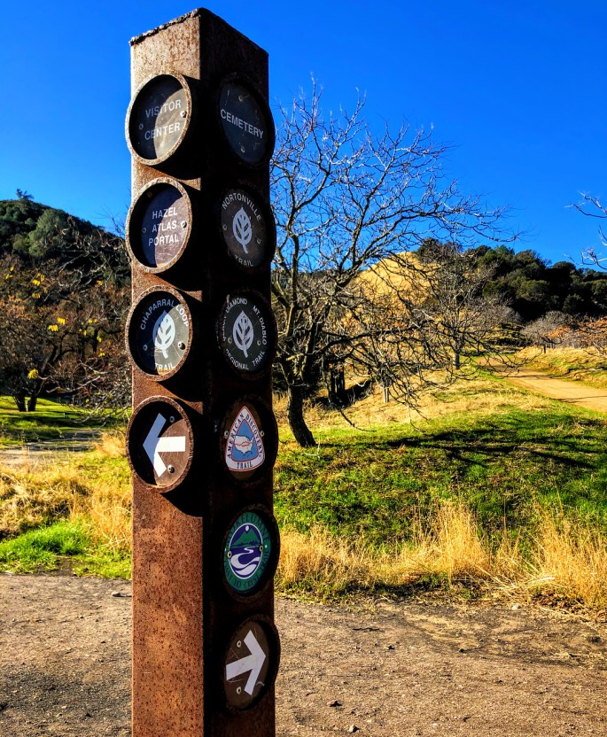
Trail posts are installed at both ends of the new section, as seen in the following images:
Trail friends at Heiser Lake Trail junction
1.1 miles later after an up and over the ridge hike down in to Pacific Valley
Please note bicycling is required to follow the highway along sections of the trail passing through Carson-Iceberg Wilderness between Lake Alpine and Ebbetts Pass. See map. Search or zoom in on the orange line in the high country to see Pacific Valley.
We updated our website & launched our nifty new interactive map in ArcGISonline. All three open segments on one map!
Free ArcGIS public accounts for laptops at argis.com
Explorer for ArcGIS by ESRI is free too, in Google Play and iTunes. No account is required to view maps. Your location will appear on the map. Quality is dependent on your browser and device.
Public safety advice: a device is not the only tool needed to safely travel on the MCCT. We recommend a paper map (pick up online or at a Stanislaus National Forest Ranger station), and/or a compass too.