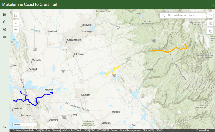
The Mokelumne Coast to Crest Trail is divided into five segments. See open segments on an interactive map by clicking on the above image.
Segment descriptions:
The Mokelumne Coast to Crest Trail is divided into five segments. See open segments on an interactive map by clicking on the above image.
Segment descriptions:

Please check your website: nothing on Calendar, and maps are also not up-to-date (i.e., nothing in 2015).
Hello Vance,
We do not have any calendar items at this time and we are waiting on official word from our agency partners for some long-awaited and exciting map updates. Thanks for checking in, stay tuned!