What an awesome quote from Dean Fleming’s Calaveras County’s Sierra Lodestar article on local hiking trails. Continue reading his report on three pages, here, here & here.
Author: maryincalaveras
Business Handshake Presentation
Just arrived home from a terrific mixer full of wonderful folks in Arnold, a small town near the trail in the Upper Mokelumne River Canyon segment. The topic was developing a ‘handshake’ with the local business community to help both sides thrive. Click on the picture to view the presentation. Thanks to everyone who welcomed the trail into the community!

Have some free time? Take a hike
That’s the title of Dana Nichol’s January 2nd Stockton Record article, reporting on this beautiful location in Camanche/Pardee segment. Thank you Dana!
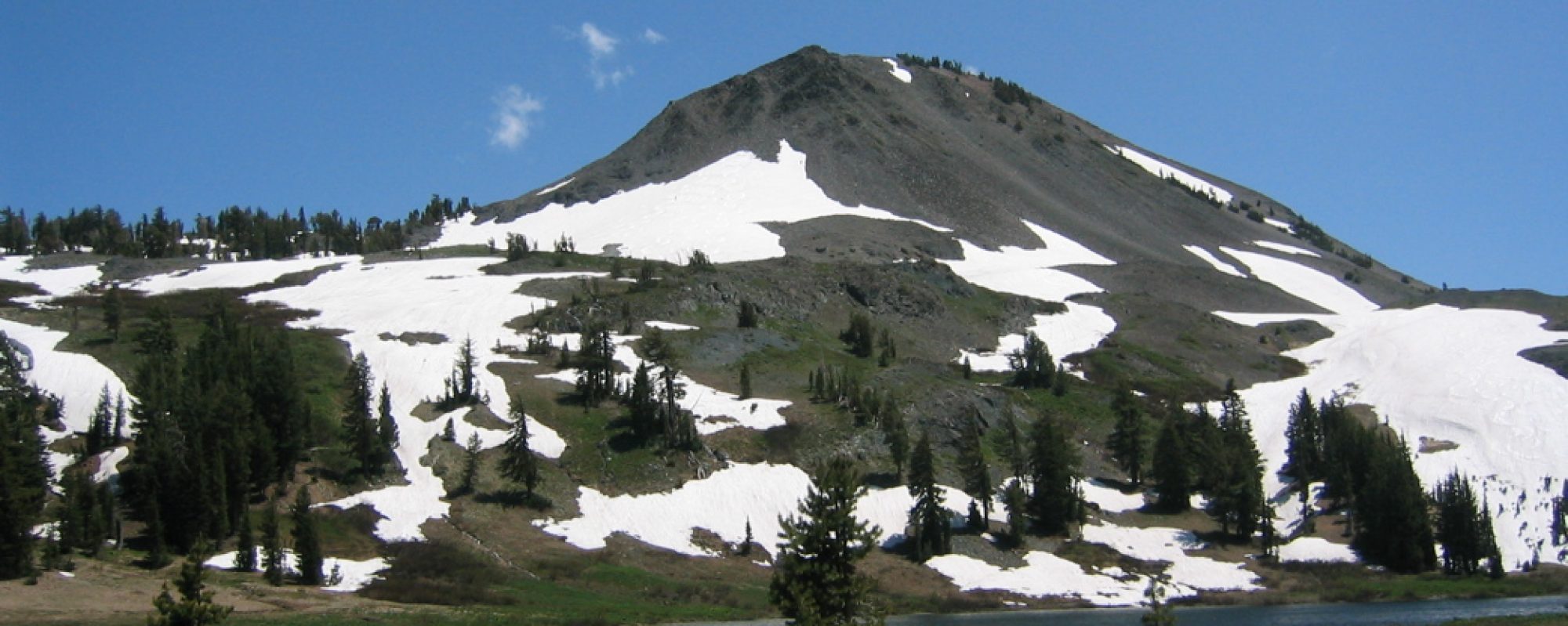
Mother nature prepares a feast for the eyes

All of this wintry, wet weather has us thinking about spring and wildflowers. We hope you enjoy these images from last year’s annual wildflower walk along the Longest Mile trail in the Camanche – Pardee segment, led by Steve Diers, Ranger & Naturalist with EBMUD.
Photos by Gary Hughes and Joel Metzger are available, we are waiting for link updates. Many thanks to Gary and Joel for taking these wildflower walk images.
This year’s Longest Mile Wildflower Walk is Saturday, April 9th. See calendar for details and learn how to make a reservation to be on this guided walk.
2010: A Productive Year
2010 involved lots of volunteers planning, building and maintaining the Mokelumne Coast to Crest Trail!

Select 2010 Year End Wrap to see the Trail Council’s 2010 review
Select MCCT’s 2010 photo albums(click on the sub albums that interest you) to see this year’s trail workers including EBMUD Trailbusters, volunteers, Mokelumne Coast to Crest trail council directors, and volunteer work crews. Many thanks to all who participated this year, we look forward to seeing you out on the trail again in 2011.
A warm welcome to East Bay-Contra Costa County segment’s first map
The Trail Council is proud to introduce the first of many brochure maps defining the MCCT as it passes through East Bay Regional parkland in our East Bay-Contra Costa County segment. The map below is courtesy of the East Bay Regional Park District (EBRPD).
About ten years ago EBRPD completed the important first step of dedicating the Mokelumne Coast to Crest Trail by “piggybacking” it on existing EBRPD trails. Next up is completing maps and trail decals on existing EBRPD posts. We are indebted to Davio Santos, Operations Unit Manager, for leading the way on these last two important steps, scheduled to be complete in May, 2011. Interpretive map panels at strategic locations will follow. We also recognize Jim Townsend, EBMUD Planning Manager, and Beverly Lane, EBMUD Board member & co-founder of the Iron Horse Trail, one of the great Rail-to-Trail success stories in the nation. Beverly is also a 2010 recipient of California’s Trail Advocacy Award, awarded at the 20th American Trails National Symposium.
We will make EBRPD maps available here for MCCT travelers as EBRPD makes them available.

A look at funding sources 2009-2010
We are blessed that over $18,000 has come in in the past year to support the Mokelumne Coast to Crest Trail.

What does that translate into for on-the-ground projects?
- trail signs and kiosks along 16 miles of trail between Moore Creek and Corral Hollow, just outside Bear Valley
- GPS technology and GIS software to complete a virtual trail planning tool on our website
- additional opportunities to scope trail alignment in the Delta region
Thanks to everyone for supporting this trail!
Pathways of Progress… discover over twenty years of progress!
2010 Year End Wrap – showcasing our 2010 accomplishments
Pathways to Progress, a wonderful introduction to the trail, over 20 years of accomplishments from 1987 – 2009 and a peek at our plans beyond 2009.
Enjoy!
