Two downed trees

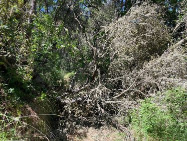
Trail supporter Tina reports two trees are down (she also sent in these photos) on Rich Gulch trail this afternoon, that for now makes the trail impassable. EBMUD is sending out maintenance crew to attend to it. Please call EBMUD Sierra Trails office at 209-772-8204 to get updates if you plan to head out there today or anytime this week. We do not have a time estimate for when the trail will be clear. Thank you Tina!

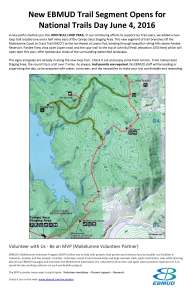
General location of the downed trees

Open now: 7 mile loop trail overlooking Pardee Reservoir

We appreciate all you do, EBMUD (East Bay Municipal Utility District)!

John Bull Trail is now open in MCCT’s Camanche-Pardee segment near Valley Springs in the Sierra Foothills. EBMUD’s announcement:

In our continuing efforts to support our trail users, we added a new loop trail located one and a half miles east of the Campo Seco Staging Area. This new segment of trail branches off the Mokelumne Coast to Crest Trail (MCCT) to the northwest at Lawry Flat, winding through beautiful rolling hills above Pardee Reservoir. Pardee View vista point (open now) and the spur trail to the top of John Bull Peak (elevation 1053 feet) which will open later this year, offer spectacular vistas of the surrounding watershed landscape.

John Bull opening flyer
Click to open PDF

Visit our Camanche-Pardee segment for trail permits, maps, weather tips and safety guidelines. Share photos and comments here or on our FB page.

Independence Flat Loop Trail Highlights

This map shows MCCT’s last area under construction by EBMUD. June 2nd, National Trails Days, is set to be an historic day! EBMUD estimates this trail’s construction will finally be completed.

Notable facts:

    • Over 1.16 miles of abandoned water ditch between Middle Bar and Big Bar will be developed as part of the new Independence Flat loop trail
    • This loop does not extend or connect east to BLM’s new Mokelumne River Whitewater Trail Big Bar Launch & parking lot at Hwy 49
    • New river access will be available along the trail. EBMUD will provide this information after the loop trail is opened. View the Google map below to learn more about river access using EBMUD’s Middle Bar Take Out located just across the river

Progress to Date:

    • Conversion of ditch remains to trail tread started in August of 2011, relying on hand tools and hard work. On average, the crew completes 150 feet a day.
    • The cross-country portion of trail is being built on 60% to 75% cross slope using a 1-ton mini excavator. With around 1,050 feet of the cross country portion complete, that leaves a balance of about 400 feet. Several gulch crossings were also developed.